OR&R's Disaster Preparedness Program and CO-OPS Exercise CURBY
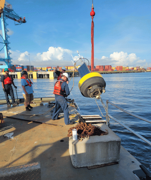
AUG. 22, 2022 — On July 26, 2022, OR&R's Disaster Preparedness Program and the Center for Operational Oceanographic Products and Services (CO-OPS) partnered to exercise the Real-Time Currents and Meteorological Buoys (affectionately known as CURBY).
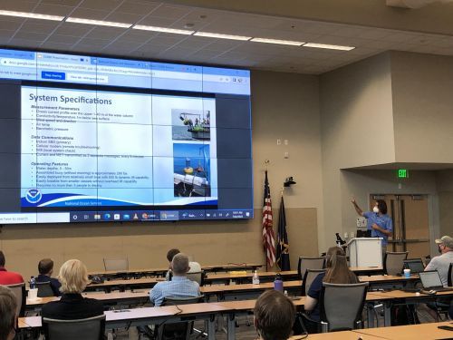
The exercise was a hybrid functional exercise held at OR&R’s Gulf of Mexico Disaster Response Center in Mobile, Alabama. This exercise was the first hybrid in-person and online exercise held at the DRC since the start of the pandemic.
As early as 2014, DPP and CO-OPS shared a vision to enhance mission capabilities in the Gulf of Mexico. The idea would influence a partnership across NOAA programs and offices that would result in two identical oceanographic/meteorological buoy systems. The systems were built to be rapidly deployed by a relatively small vessel if a fixed monitoring station was damaged and there was a need for real-time data.
Funding was made available through DPP’s Lagniappe Funds, which provides limited funding to enhance National Ocean Service disaster preparedness. The buoys are a NOAA scientific asset that can be used to support planning and operational decision making during scientific research and emergency response.
The exercise included a series of informative sessions that featured the tools and data available from NOAA CO-OPS, an introduction to the CURBY system, and steps necessary for deployment, including expert guidance for environmental compliance activities. To analyze access, activation, and mobilization of CURBY, the exercise focused on six objectives:
- Demonstrate access to CURBY with jurisdictional, regional, private, and federal partners for future deployment.
- Demonstrate procedures to complete environmental compliance activities in accordance with the NOAA Environmental Compliance Program Policies and Procedures.
- Demonstrate the ability to access, activate, mobilize, and deploy CURBY as outlined by the field user guide.
- Under field conditions, evaluate the ability of CURBY to establish and support data visualization.
- Evaluate the ability of the CURBY data (as well as other real-time data and products like the Marine Channels Forecast) to support situation assessment and provide summary documentation to scientific support coordinators and damage assessment teams.
- Evaluate the ability of non-NOAA partners to access and effectively utilize the data visualization platforms.
Prior to the exercise, NOAA staff with the assistance of the United States Coast Guard Sector Mobile, deployed the buoy using a Coast Guard vessel. Buoy location was predetermined in partnership with APM terminals, Alabama State Port Authority, the Coast Guard, and NOAA.
Thirty-two participants attended from various offices across NOAA, the United States Coast Guard, United States Army Corps of Engineers, Alabama State Port Authority, Dauphin Island Sea Lab, and APM Terminals. Engagement and contributions from participants will be used to inform future developments to the CURBY systems. The planning team is compiling notes and feedback into an After-Action Report.
This exercise was sponsored by the NOAA Gulf of Mexico Regional Collaboration Team.
 An official website of the United States government.


