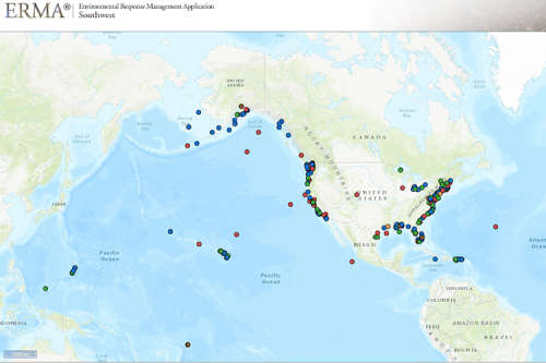
Map of the Month: A Look at Marine Debris Projects
The Environmental Response Management Application (ERMA®) is NOAA’s online mapping tool that integrates both static and real-time data, enabling users to quickly and securely access, analyze, and display spatial data. The "Map of the Month" series highlights unique maps from throughout ERMA's use and history.
This map demonstrates the interoperability of ERMA with other applications within the Office of Response and Restoration and highlights projects from the NOAA Marine Debris Clearinghouse.
The Clearinghouse is an online database that serves as the federal government's hub of information for marine debris stakeholders on projects that are underway or have been completed. It is intended to help improve the state of knowledge on marine debris, promote collaboration, and spark ideas for future removal, prevention, and research activities.
Data displayed are from debris research, prevention, and removal efforts funded or otherwise supported by the NOAA Marine Debris Program. The multi-colored points represent different project type categories such as marine debris removal, prevention, and emergency response locations. Click here to view the map online.
By clicking on the individual colored dots you can see information about the specific project and link to the Marine Debris Clearinghouse project details directly. You can also click here to access the Clearinghouse and filter and query these projects directly.
March’s Map of the Month comes from the Spatial Data Branch’s Adam Rotert in Silver Spring, Maryland.
 An official website of the United States government.
