Next Generation Environmental Sensitivity Index Workshop
OCTOBER 19, 2020 — OR&R will host a Next Generation ESI Workshop—with stakeholders across multiple USCG Districts—to brainstorm ways to improve the process of updating Environmental Sensitivity Index (ESI) maps.
The goal of the workshop will be to determine a solution to make ESI map updates cheaper and faster, while retaining their accuracy.
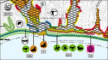
These maps provide a concise summary of coastal resources including biological resources, sensitive shorelines, and human-use resources that are at risk if a disaster such as an oil spill occurs nearby.
The workshop will be held one day a week over the course of four weeks, with the first session beginning Oct. 28. It will include strong representation from NOAA, other federal agencies (U.S. and Canada), state agencies, tribes, resource trustees, contractors, and congressional representatives.
For further information, contact Nicolle.R.Rutherford@noaa.gov.
 An official website of the United States government.

