 An official website of the United States government.
 March 24, 2025

New Job Aids and Training on Uncrewed Aircraft Systems Guidance for Oil Spill and Disaster Response, Assessment, and Data Management
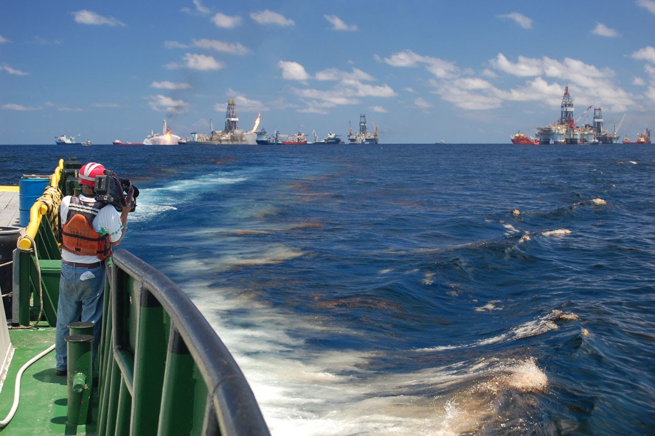
OR&R and the U.S. Coast Guard (USCG) are advancing oil spill and disaster response through cutting-edge research and development focused on oil spill science, remote sensing technology, and data delivery. Under a five-year operational agreement, OR&R and the USCG have committed to using OR&R’s web-based geographic information system tool ERMA® as the common operating picture for oil spill and natural disaster response and training. To support this interagency agreement, OR&R and partners have developed best practices and training materials to aid USCG pilots and other responders in effectively collecting and delivering imagery for oil characterization and mapping.

OR&R Supports 17 Incidents in January 2025
During January 2025, OR&R provided response support for 17 incidents, including 15 new incidents in eight states, Washington DC, and one territory (Puerto Rico). Twelve of the new incidents were actual or potential oil spills, and three were chemical incidents (natural gas, urea, and a lithium battery fire). View the full list of OR&R's January incident responses.
National Ocean Service Experts, Technology Support DCA Aircraft Collision Recovery Efforts
In the wake of the aircraft collision over the Potomac River near Ronald Reagan Washington National Airport (DCA), NOAA’s National Ocean Service activated response teams to support response and recovery efforts. NOAA worked alongside the USCG, National Transportation Safety Board, U.S. Army Corps of Engineers, D.C. Fire and Emergency Medical Services, and other local and federal partners to locate wreckage, support search and recovery efforts, and ensure safe navigation on the Potomac. OR&R supported these efforts by providing marine pollution and trajectory forecast support.

OR&R Exercises Earthquake Preparedness and Response with Interagency Partners in New England
Earlier this year, OR&R’s Disaster Preparedness Program Regional Preparedness Coordinator for New England participated in a Federal Emergency Management Agency (FEMA) Regional Interagency Steering Committee meeting and exercise in Beverly, Massachusetts. The table-top exercise discussed how state and federal agencies could respond to an earthquake in New England. While earthquakes in the region are relatively rare, a 3.9-magnitude earthquake occurred of the southeast coast of Maine occured on January 27, 2025, only three days prior to the exercise. Meeting presentations and discussions covered the history of earthquakes in New England, earthquake impacts, and search and rescue operations. OR&R shared information on NOAA capabilities related to earthquake preparedness and response, including aerial overflight surveys by the National Geodetic Survey, environmental assessment, and mapping products.

NOAA Supports Planning for Coast Guard Hurricane Exercise
OR&R is supporting planning for this year’s Hurricane Exercise (HUREX), a training event focused on reinforcing and enhancing security and preparedness for hurricane season. HUREX helps prepare personnel to respond to adverse weather conditions in U.S. coastal regions, maintain the ability to deploy responders under the most severe conditions, and keep personnel and assets safe through the storm in order to resume all mission critical activities once safe to do so. The exercise, taking place the week of May 12, will engage all USCG District 7 sectors with a scenario-driven exercise. OR&R is coordinating closely with the National Hurricane Center to provide a suite of hurricane forecast products that will help the USCG establish response and recovery actions and priorities during the exercise. Over the week-long event, NOAA’s Scientific Support Coordinator (SSC) assigned to USCG District 7 will provide emergency scientific support and coordination, and OR&R’s Spatial Data Branch will provide ERMA support. Serving as the exercise’s common operating picture, ERMA provides key information to help USCG evaluate response decision-making, scope and priorities, and track progress throughout the event for all units within the area of operation.
NOAA Supports Disaster Preparedness, Response, and Recovery Conference
Disasters Expo USA is a key event for disaster preparedness, response, and recovery, bringing together industry leaders, government agencies, and professionals committed to address the challenges of disasters. This spring, the NOAA Scientific Support Coordinator (SSC) assigned to USCG District 7 participated in the Miami event, along with USCG representatives from District 7. The Disasters Expo addresses many disaster-planning topics through expert lectures, demonstrations and exhibits. The NOAA SSC served on the Expo’s awards committee to evaluate exhibits entered as finalists for the 2025 "Life Saving Solution of the Year" award.
Web Highlight
Get to "NOAA" the National Ocean Service and the Many Services We Provide
NOAA’s National Ocean Service (NOS) has a unique mission that includes some of the most interesting parts of government. NOS is America’s leader in coastal and ocean science, technology, and management. We balance economic and environmental needs and deliver tools and services that directly support national security and the public. Dive in to learn more about how NOS works for you each and every day.